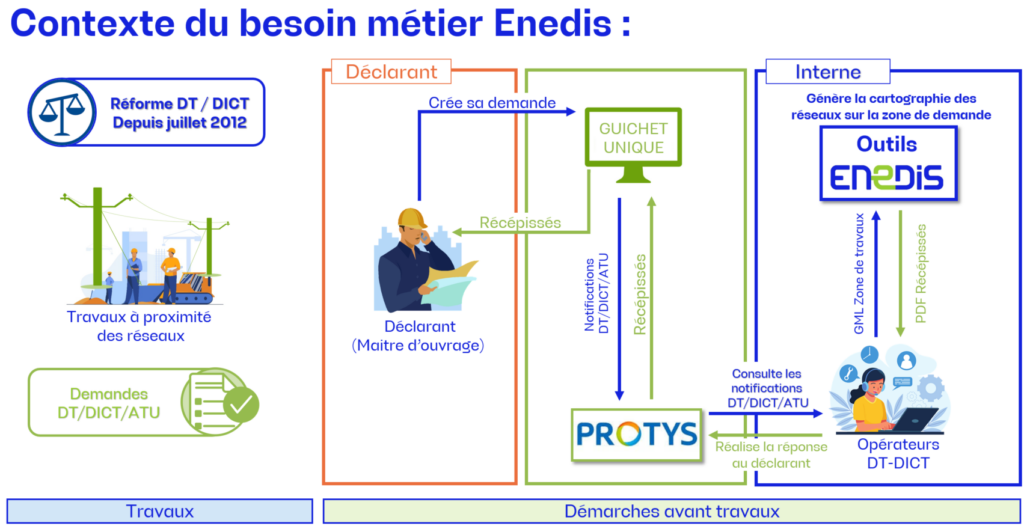
Enedis' need for mapping applications
Enedis is the operator in charge of the electricity distribution network in mainland France within the framework of public service delegations. It is the largest network in Europe. Enedis is responsible for its operation, development and maintenance. The Geomatics Domain of the Engineering, Heritage and Infrastructure Department (IPI) of Enedis' PRISME Pole organizes and rationalizes the management of mapping projects and applications.
Geomatics applications for managing and monitoring works
Thanks to its expertise in digital geography and application development, Magellium Artal Group has developed the @DDICT application, comprising a Web Portal and an Automaton, which aims to provide answers to work requests from various contractors, in compliance with European regulations:
- DT: Déclaration de projet de Travaux (Declaration of proposed works)
- DICT: Déclaration d'Intention de Commencement de Travaux (Declaration of Intent to Begin Work)
- ATU: Avis de Travaux Urgents (Notice of Urgent Work)
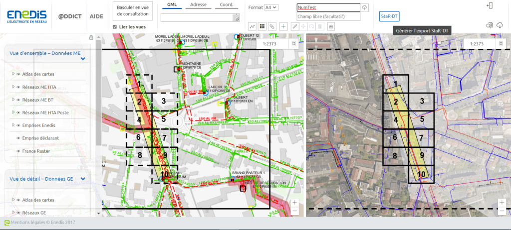
In mainland France and for the SEI (Systèmes Energétiques Insulaires), these answers are given in the regulatory PDF format, but also, when available, in the StaR-DT format (STandard géographique de Réseaux pour les réponses aux Déclarations de Travaux).
This project is linked to the PROTYS platform created by the seven major French network operators (Enedis, GrDF, GRTgaz, SUEZ EAU France, Orange, RTE and TEREGA) to share the management of DT, DICT and associated receipts.
Our missions on this application development project
We are involved in several aspects of this project:
- Functional specifications / User Stories
- Application design, development and evolution.
- Application maintenance on a critical system in Production: More than 1,000 agents use the application every day.
- Writing and updating User Manuals, Installation Manuals and Operating Manuals.
- Implementation of DevOps best practices to optimise the :
- Productivity improvement: CI/CD,
- Code quality improvement: SonarQube, Checkmarx,
- Deployment automation: Kubernetes,
- Test automation (TEASER).
- User support
The project is managed using Agile at scale (SAFe).
Our team implements cutting-edge geomatics development technologies with tools such as :
- ESRI (ArcGIS Suite) for cartographic management,
- PostgreSQL/PostGIS for spatial databases,
- FME for StaR-DT data processing,
- OGC Webservices for interoperability,
- PHP, JavaScript, Python for web application development,
- Kubernetes for container and deployment management,
- SonarQube, Checkmarx for healthy code.
New features to modernise the Enedis application
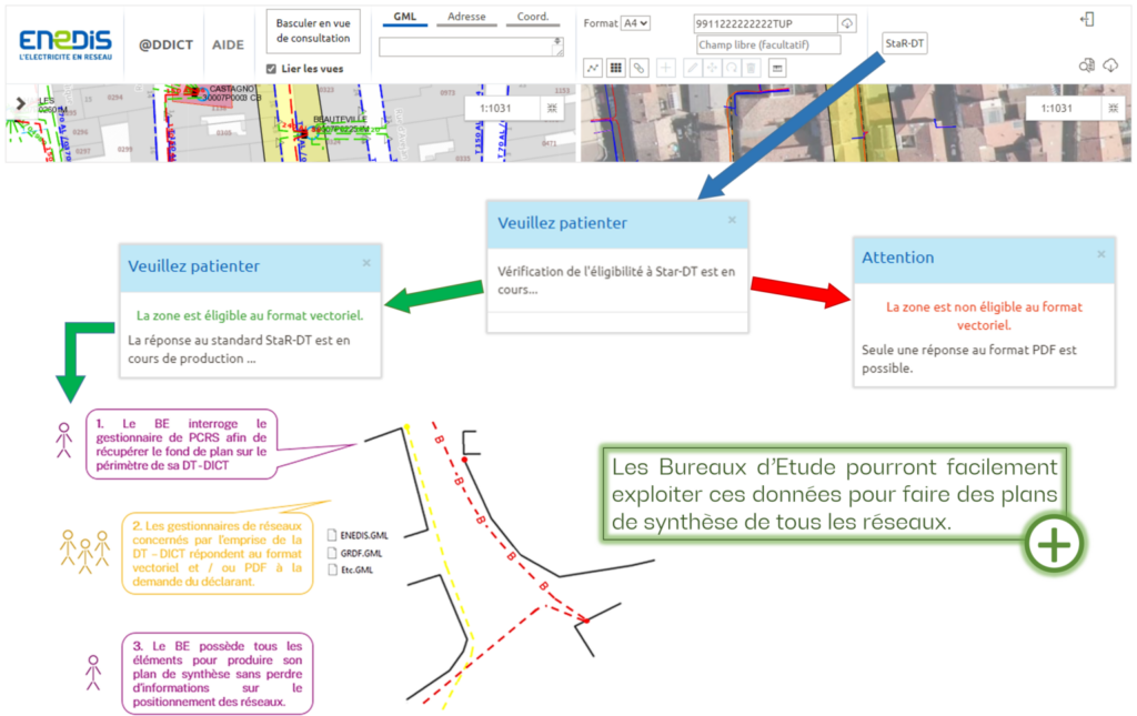
Since November 2022, the Portal has also been available in StaR-DT format. Design offices will be able to easily use this data to produce summary plans of all networks.
Since January 2024, activation of "Functional Alerts" (GAF) in PROTYS partner dashboards to enable Enedis DT-DICT operators to obtain a pre-analysis of the criticality of work requests and anticipate likely worksite protection requirements.
This @DDICT project illustrates Magellium Artal Group's ability to support major customers like Enedis in deploying advanced technological solutions, and to meet the performance and safety challenges of the French power grid.